
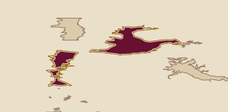
Columbia Gorge straddles the Columbia River on the Oregon-Washington border. The climate shifts from a cool, wet west with 36 inches of rain to continental high desert in the east, where rainfall is 10 inches. Vineyards range from sea level to 2,000 feet. The wines are often riper than those from western Oregon, while retaining more acidity and structure than wines from warmer eastern appellations.
Continue through the region
Elsewhere in Oregon
- Columbia Valley5 producersColumbia Valley extends beyond Oregon into a much larger growing region centred on Washington. Its broad label can cover very different wines, so the producer is useful context when choosing a bottle.
- Southern Oregon1 producerSouthern Oregon has five nested AVAs shaped by four rivers and a wide range of growing conditions. Cooler areas favour Pinot varieties and Sauvignon blanc, while warmer areas ripen Cabernet Sauvignon, Tempranillo and Syrah.
- Willamette Valley13 producersBetween the Coast Range and Cascades, Willamette Valley follows the river of the same name for more than 100 miles. Pinot noir leads, with Pinot gris, Chardonnay and Riesling alongside it.